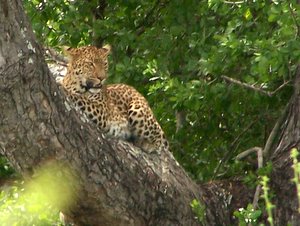
Malelane in the Kruger National Park
Malelane Camp in the Kruger Park is a unique little camp. Situated on the Crocodile River, one has a view of the farms on the other side. Malelane is a small, intimate little camp without any shops, but with good facilities for large groups, like families or other groups. It is well-suited for those who wants to enjoy some exclusivity, but still being near the most important creature comforts, like shops nearby in Berg-en-Dal Restcamp or even outside the park in Malelane Town.
Malelane camp has five self-catering rondawels (round thatched bungalows) and fifteen campsites with electricity, making for a rather quiet and peaceful experience, except maybe for the little monkeys who never let an opportunity to relieve you of any unguided food that you may have, pass them by.
Camping in Malelane Camp is normally a good experience with only a few smallish trees that makes it a wise move to try to get to camp early if you plan to stay a few days. What actually makes Malelane very enjoyable is the small number of people, that makes for peace and quiet especially if one visits out of season when you can sometimes be lucky to be the only visitors to Malelane.
Places to visit in the vicinity are the Matjulu Waterhole, Afsaal picnic site, the Gardenia Hide, Renosterpan and others.
For game drives, walks, bush breakfast and bush braais, enquire at the Malelane gate office when you book into the Camp, which cannot be done at Berg-en-Dal.
For Sanparks online reservationsClick Here
We recommend the following trip to the immediate surroundings of Malelane Camp.
Distance 153 km.
Drive Time without stop = 4 hours
From Malelane hop onto the S110 left and go past Berg-en-Dal Restcamp if you do not want to visit their restaurant for breakfast or their shop for something to drink or eat.
Then, on with the S110 towards the Matjulu Waterhole, which is one of my favourite places in the southern part of the Kruger. On the way there, keep your eyes peeled for animals like rhinos, elephants lions or maybe even a leopard, since this is very good gameviewing country, there is seldom a day that you do not see something very rewarding.
Upon nearing Matjulu, you will look down at the waterhole and then make a left turn by the concrete reservoir where you can move into a good spot to spend some time watching.
From Matjulu, return to the S110 and turn left and left again at the S120, the Steilberg(Steep Mountain) from where you can enjoy several good views over the surrounding mountains.
Further on to Renosterpan Waterhole where there is always some animal life to appreciate before going to Afsaal (off saddle) Picnic Spot for something to eat. One can make one's own food or order something to eat from the kiosk.
Between Renosterpan and Afsaal make sure to watch out for the Hyena den under the road in one of the culverts. It is occupied by a large brood of Hyenas, who are actually not afraid of cars and they make excellent film stars, playing with and feeding the young ones while the old folk lie around in the shade watching tourists.
From Afsaal take the H3 north towards the Stevenson-Hamilton stone lookout. Afterwards carry on towards the S114 and the Renosterkoppies Dam. We have seen lions quite often in this area, so be on the lookout when getting out of the car at the Rock.
Then on to the South and turn right into the S23 towards the Biyamiti River for a drive next to this game-rich riverbanks to the Biyamiti Weir where you can sit under a shady tree on the southern bank to watch the animals and tourists go by.
Finally, carry on with the S114 for a last visit to the Matjule Waterhole to make sure you do not miss anything interesting, before going on to Berg-en-Dal Restcamp for a wonderful evening next to the fire and some good South African red meat on the grid while enjoying a good SA wine or beer. Heavenly.
In order to help people to get to know the Kruger Park better, we wrote a book containing large pictures, short descriptions, GPS Coordinates and travel times of more than 300 waypoints like camps, picnic spots, waterholes, dams, viewpoints and other interesting points along all of the public roads of the Kruger Park
The book is written in the form of a 20-day tour, taking the reader on a virtual tour through the park, giving the reader a rare graphical oversight over the park. Use the many GPS Coordinates to enjoy a pre-visit to the different places on Google Earth to make your virtual tour even more fun!
Although it is possible to follow the routes in 20 days, few people have the time available to travel all the routes described in the book, therefore it will be a good idea to download the book and do the virtual tour and then, after that experience, to design your visit to the Park as well as the trips and places you want to see and experience. .....read more"
CAMP REPORTS
TRIP REPORTS


